Back to top

Policies

If you are a professional archaeologist with at least a master’s degree in archaeology or anthropology or currently hold a Registered Professional Archaeologist (RPA) or Registered Archaeologist (RA) certification, please make requests by email gasf@uga.edu or by phone 706-542-8737. Due to Georgia law, site location and information is protected (OCGA 50- 18-72[a][14]). Please see Important State and Federal Laws for more information. Therefore, if you are not a professional archaeologist then we cannot accommodate your request. Attached is the updated policies for GASF.

For Cultural Resource Management firms and other professional archaeologists seeking Site File access for research related to contract-based projects, please review the policy outlined below.

A fee of $385 per project search will be charged for funded projects by CRM firms and agencies for access to the Site File. A fee of $77 will be charged per tower search, including railroad PTC tower searches. This fee, due within 30 days, is necessary to cover the cost of the operation and management of the Site File. Any number of in-house visits to and uses of the Site File may be made for any individual project through the payment of a single fee within six months of the original invoice date. However, an additional paper search completed by Site File staff and provided to a client remotely will be charged a new project fee and not considered a project revisit.

Site File searches may be conducted in five ways:

  1. Site File personnel will conduct the search for users for a fee of $30 per hour after the free first hour plus the $385 project fee.
  2. For the standard project fee of $385, the user's own staff may conduct the research at our facilities. If staff other than site file personnel conducts the research, they must meet minimum professional standards for an archaeologist, or be working under the supervision of an archaeologist that meets professional standards.
  3. Firms can conduct their own searches online through GNAHRGIS. Access can be granted for particular counties for a short period of time (4 months) per project, with the standard project fee of $385 still applied.
  4. Firms can conduct multiple searches using all-county, annual access to GNAHRGIS for a fee of $5,950. GASF does not prorate the annual fee but offers access for 12 months following the date of access granted. 
  5. Engineering and environmental firms without an archaeologist will not be allowed to access site information.

However, site file searches with limited information about site location may be conducted or requested by non-archaeological professionals with non-CRM firms if all the following conditions are met:

  • The representative of the environmental, geological, or engineering firm attests, as a professional in his or her field, that information obtained from the Georgia Archaeological Site File will not be divulged to any party other than the client for whom the engineering firm is conducting the research.
  • The environmental, geological, or engineering firm accepts that the following information will not be provided: maps, site numbers, site forms, information within site reports (only number and abstract is provided).
  • Additionally, environmental, geological, or engineering firms who do not have a professional archaeologist on staff accept a paragraph outlining the limitations of Site File research (see Paragraph of Disclaimer below), which the GASF strongly recommends be placed in the firm's report to their client.
  • The environmental, geological, or engineering firm accepts that the project fee of $385 is still applied.

IMPORTANT: For the purposes of access and invoicing, GASF defines an archaeological project as an enclosed boundary of investigation involving a single search radius originating from a point, a line, or a polygon. If a firm or agency requests a single project search requiring more than one search radius, such as for a multi-intersection survey, GASF must also be provided with documentation supporting why the request should be considered as a single project and subsequently charged under a single project fee. If GASF determines that supplemental documentation is sufficient to warrant results from multiple search radii as a single project search, there will be a surcharge of $35 included with the total service cost for every additional search radius produced following the first search boundary. For example, if a multi-intersection project requires three search radii, there will be a surcharge of $70 added to the total cost of GASF services for the two additional search radii produced for the investigation.

Agents must choose from the following search radii for either project or tower searches. Environmental searches must meet the minimum required search radius.

  • Project Search
    • kilometers: 0.25, 0.5, 0.75, 1, 1.5, 2
    • miles: 0.5, 1
  • Tower Search
    • kilometers: 0.25, 0.5, 0.75, 1, 1.5
    • miles: 0.5, 1

*maximum search radius for any tower search is 1 mile


For professional archaeologists seeking access to Site File data for the purposes of academic research or nonprofit work, please review our academic research policy below.

Georgia Archaeological Site File (GASF) data is available for qualified individuals upon request for the purposes of academic research at no charge to the researcher. Anyone wishing to receive research access to Site File data must fill out a GASF Access & Use Researcher Agreement and email it to gasf@uga.edu. All research access requests will be reviewed and approved on a case-by-case basis.

Please note that exceptions to qualification requirements can be made for current students if they submit additional documents provided by a supervisory professional archaeologist, including (1) a signed letter of acknowledgement by the qualified supervisor, and (2) the curriculum vitae of the qualified supervisor.

Paragraph of Disclaimer

Although research conducted at the Georgia Archaeological Site File is useful for gaining a preliminary understanding of the distribution of archaeological resources in a given area, there are important limits to this data that must be understood to evaluate the data properly. First, the presence of a few sites in the area of interest does not by any means imply that the locations of all sites in the area are known. In most cases the data are quite spotty. Second, archaeological salvage and mitigation work on known sites may ultimately turn out to be less expensive than the mitigation of unknown sites discovered later in a project. Human settlement has traditionally been centered upon well-drained soils on level ground with a nearby fresh water supply. While locales meeting these obvious criteria are certainly more likely locations for archaeological sites than other locations within a project area, there may be sites located anywhere within an area. In light of these factors, it is prudent to seek the consultation of a professional archaeologist to assess the possible impact of a proposed project on its cultural resources.

In addition to our policy, the Historic Preservation Division of the Georgia DNR has issued a memorandum to which contract archaeologists should pay special attention.

Image
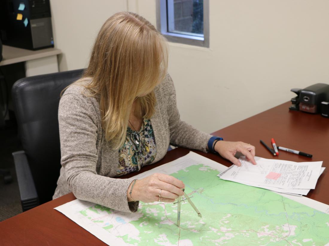
woman with a quad map doing a site search